Hurricanes-Tropical Storms


NHC -- NHC - click here

NHC -- NHC - click here -NHC WAP - CPHC -- JTWC WWO
NOAA Storm Tracker click at site for storms in tracking
MEXGob SMN CNABoletin Pacifico/Atlantico[TWC] TWC NWS WARNINGS WX
Images and info at Links below:


ATLANTIC Hurricane IRENE .. now off Carolinas heading [020] NNE 13 mph .. will skirt US East Coast .. see NHC .. TWC for more ..Warnings/for most of US Eastern seaboard & inland .. see NHC-SMN ... for more

WEST PACIFIC Super Typhoon Nanmodal [Typhoon Mina -Philippines] North Philippines - Luzon now .. heading North toward Taiwan .. see .. PAGASA ...JMA .. HKO .. for more...
WEST PACIFIC TS TALAS 15-W West Pacific heading northward to Honshu .. see JMA .. HKO .. for more
Typhoons Satellite Images
Tides-Flood-Wave Danger
Emergency Agencies Météo World WX NOAA Links
RADAR
MONSOON
TRACKING
ATLANTIC WATCH
NOAA NHC Marine Forecasts  
Tropical Weather Outlook Graphic Version (& short text)
Tropical Analysis Forecasting Branch [Tropical Weather Discussion]
Atlantic Tropical Weather Discussion NHC wap NHC mobile
CPHC Trop Outlook
NOAA Weather Map-North America

page bottom non-tropical wx HPC - NWS

WMO has replaced JTWC as lead WX info source by regional weather forecasting agency.
(ie USA-Japan-France-Canada-Australia-India in regions)
NHC Active Storms
SAT IMAGE THPHOON MEGI
MSFC NASA GOES
Hispaniola Leewards PR VI close-up

Florida & Carolinas IR-4 MSFC
HIS-CU-JA MSFC IR-4
MSFC Louisiana Coast IR-4
Louisiana Coast MSFC IR-B&W
Louisiana Coast MSFC WV-IR-B&W

MSFC Gulf Coast & Caribbean & Florida & Bahamas IR-4
MSFC N America IR-4

MAPS -- CHARTS
NOAA Weather Map-North America
NOAA Atlantic WInd/Wave Danger
NOAA Pacific Wind/Wave Danger
Gulf of Mexico Weather Chart NOAA

Caribbean Weather Chart NOAA TAFB Ocean & Surface Analysis
NOAA TAFB Charts & Forecasts site

NOAA Tropical Storm by Basin Chart :: image map & list
NOAA-Caribbean Satellite

SHARK OIL BERMUDA

NOAA Atlantic Tropical Storm Imagery-Satellites

NOAA Satellite Images - Atlantic/Caribbean/Gulf/East Pacific -- Floaters/Tracking Sats
Météo RF Tracking Satellite Tagant
Météo RF BiSat IR Atlantique
Météo RF Carte de Vigilance
NOAA Gulf of Mexico Satellite b
NOAA GOES-WEST East Pacific
NOAA Tropics Floaters (for West Pacific scroll down)

MTSAT via NOAA Satellite images west Pacific Floater


U-Hawaii Tropical Storm Tracker
NOAA Indian Ocean IR Image
NOAA Tropical South Indian Ocean- Storm Positions
S Pacific WWO
FAR EAST TC & TYPHOON WATCH
JTWC Active Typhoon Tracking Satellite Fix/Storm 'eye' Location
JMA [TC] Typhoon Tracking
NOAA MTSAT RGB [color] Sat Image

GOES Far East IR Image NASA-MSFC
GOES Far East IR B&W Image NASA-MSFC
TWC Asia Satellite
WWO-TropWX
JTWC
JMA Typhoon Center
NPMOC-JTWC -US Navy Typhoon Tropical Storms site

GOES Far East IR Image NASA-MSFC
GOES Far East IR B&W Image NASA-MSFC

NOAA MTSAT Storm Floaters Far East & Pacific [Home Page]
USA Floater Series for Far East - NOAA MTSAT [file tree-active]
[use appropriate 'floater' satellite per storm/region]
Asia NOAA Satellite Visible B&W Image
Asia NOAA Satellite RGB Image

TWC Asia Satellite
TWC Asia Satellite

WWO-TropWX
TWC Hurricane/Typhoon Central
JMA Track
JTWC
JMA Typhoon Center
Hong Kong Tropical Cyclone Info
NPMOC-JTWC -US Navy Typhoon Tropical Storms site
NOAA Indian Ocean

PAGASA

NOAA-NNVL static images near-time for current storms

GOES- Global Composite Image Far East IR-4 via NASA

GOES IR-Sat Image Full DIsk [hemispheric] - Pacific & Far East MTSAT

GOES Visible-Sat Image Full DIsk Pacific & Far East MTSAT

more at Typhoon click here


CLICK Storm & Sector for Tracks & Images

If ...NASA GOES service is down --- see NOAA as well
NWS RADARS

NWS Mobile WX & Radar Lite
NOAA-NWS RADAR HOME
NWS Radar Lite version
NWS San Juan Puerto Rico Radar
NWS Reflective Base Radar Guantanamo Bay Cuba (MCB-GTMO)
[also for US-FAA] with Jamaica & passage

NWS Radar San Juan & Eastern Cuba
Mexico - Gob. Coastal Radar [CONAGUA]
Mexico - Cancun Radar :: HurricaneAdvisories.com
METEO France Antilles Radar
NWS Guantanamo Cuba
Martinique Radar [RFrance]
Weather NL Antilles Cyclones Page [Radar link]
Aruba Radar [java required]
Gov Bahamas Long Range/Local Radar
Gov Bahamas Radar & WX Links
Panama Canal Company (Carib & Pac apprches)
"FLY SOUTH" Int'l Radars Page


NOAA East Conus Satellite IR-4
IR CONUS-EAST COAST NOAA IR B&W

Satellite Imagery - NOAA Special Storm Sat Imagery

NOAA-West Coast CONUS IR-4
NOAA-West Coast -CONUS IR B&W

TWC HURRICANE CHARTS & MAPS
(The Weather Channel)

ATLANTIC WATCH
--- Watch -- Atlantic E of S America-Venezuela & Windward Antilles --
IR CONUS-EAST COAST NOAA
NASA-GSFC GOES-12 IMAGE full color -latest USA-East
GOES 12 NASA-GSFC Color Image Latest USA-West
WIND WARNINGS ATLANTIC
NOAA East Conus Satellite
NOAA OPC [ocean prediction center] Atlantic & Pacific [surface analysis weather maps & charts]
Atlantic Weather Map

NOAA GOES-NHE satellite image IR-4 NASA MSFC

Sat images via Goes FULL Sat image see NHC above WV=water vapor IR=infra red VIS=visible 4=cloud color multi palette -GOES via NASA (for other images use 'satellite images' speed tab)

Lat 28 Lon 64
IR

Lat 29 N Lon 80 W
VIS-IR
IR- B&W
IR-4
WV-IR4
WV-IR

Lat 29 Lon 64<,/b>
IR image zoomed out
VIS image zoomed out
IR-4 image zoomed out

GOES E Hurricane 20 SAT via NASA
IR-4 IR
WV-IR-4 -blue tones = cooler condensation
WV
VIS B&W

Air & Ocean Currents
N Atlantic Jet Stream
Atlantic Gulf Stream Chart
Gulf Loop Current
Gulf Of Mexico Loop Current -NOAA
NOAA OPC [ocean prediction center] Atlantic & Pacific [surface analysis weather maps & charts]
Atlantic Weather Map

ATLANTIC Tropical Storm Watch

NOAA Image Central Atlantic

Ocean & Sea temperatures- Atlantic
MET-8 Sat Image East Atlantic via NOAA
NOAA Sat Images tropical Atlantic-Caribbean links
TWC Tropical Weather Atlantic Satellite Image
NOAA-NHC Atlantic WInd-Wave Danger

NOAA-NHC tracking charts & Forecast here
NHC forecast link
Ocean & Sea temperatures- Atlantic
Europe's MET-8 Sat Image East Atlantic via NOAA
NOAA Sat Images tropical Atlantic-Caribbean links
TWC Tropical Weather Atlantic Satellite Image [not NOAA but the Weather Channel -TV]

NOAA OPC [ocean prediction center] Atlantic & Pacific [surface analysis weather maps & charts]
Atlantic Weather Map


34N 46W
IR-4 zoom 1 GOES via MSFC NASA
IR-B&W zoom 1 GOES via MSFC NASA


NOAA GOES-E FULL SAT Images via NASA-MSFC
MSFC-NASA GOES-Sat Image Yucatan >> Campeche IR B&W
MSFC-NASA GOES-Sat Image Yucatan >> Campeche IR-4

FLORIDA-KEYS-BAHAMAS

FLORIDA BAHAMAS

Florida-Keys-Bahamas

CARIBBEAN & HIS-CU-JA
CARIBBEAN &
HIS-CU-JA
CARIBBEAN::HIS_CU_JA zoom out
HIS-CU-JA-zoom2[in] NOAA-MSFC IR-4 SAT
NASA-MSFC HIS-CU-JA - IR-4
NASA-MSFC HIS-CU-JA - B & W
NHC-NOAA WInd Wave Danger -E.Pacific
IR-4 B&W Global Composite Sat image via NASA-MSFC
IR B&W Global Composite Sat image via NASA-MSFC

ATLANTIC WATCH - Look forward

29N by 37W - Azores
Sat-image GOES Atlantic Image IR-4 aimed 29N by 37W
Lat 15N Lon 67W Zoom factor 1 GOES SAT WV-IR

Lat 15 N & Long 54W
Antilles >> East
[Sat Images zoom factor 1]
WV-IR
WV-IR-4
IR-4
VIS
IR


Lat 12N & Lon 40W (zoom factor 1)
Antilles >> East Atlantic -- Caribbean Portal

WV-IR
WV-IR-4
IR-4
VIS
IR

Broad Atlantic View
this image - US Coast & E of the Greater Antilles adjoining the Gulf Stream .. see equatorial current from Africa in images below
zoom factor 1 VIS Lat 23N Lon 44W
zoom factor 1 IR Lat 23N Lon 44W
zoom factor 1 IR-4 Lat 23N Lon 44W
zoom 2 VIS Lat 23 Lon 44w
zoom 2 IR Lat 23 Lon 44w
zoom 2 IR-4 Lat 23 Lon 44w

NOAA OPC [ocean prediction center] Atlantic & Pacific [surface analysis weather maps & charts]
Atlantic Weather Map

Weather Maps Legend [symbols key]
Tropical Analysis Forecasting Branch [Tropical Weather Discussion]
Atlantic Tropical Weather Discussion

NHC-NOAA Atlantic TS WInd-Wave Danger

Typhoon Watch
NPMOC-JTWC -US Navy Typhoon Tropical Storms site
For active storms -- see JMA or JTWC for tracks & more images -click Typhoon below for more

Global Composite SAT via NASA IR-4 Image
Global Composite SAT via NASA IR B&W Image
YAHOO-TWC Asia Satellite -francais
more at Typhoon click here

NOAA-Wind/Wave Danger E Pacific

NOAA OPC [ocean prediction center] Atlantic & Pacific [surface analysis weather maps & charts]
Atlantic Weather Map


CPHC
Central Pacific Hurricane Center
SEE CPHC & JTWC LINKS - BULLETINS
NOAA-NWS CPHC
GOES Global Composite via NASA MSFC IR-4 NA-West to Hawaii
GOES E FULL 18.0N 141.0 W E Pacific Mexico >> Hawaii IR-4
GOES E FULL 18.0N 141.0 W E Pacific Mexico >> Hawaii IR B&W
NOAA Pacific Hurricane Floater IR
GOES W-Pacific-US IR PACUS >Hawaii
Global Composite IR via NASA MSFC
TWC Hi-SAT
NOAA-NWS CPHC
NOAA Wind-Wave Danger East Pacific
NOAA Satellite Series Central & East Pacific
NOAA OPC [ocean prediction center] Atlantic & Pacific [surface analysis weather maps & charts]
Atlantic Weather Map

NWS Radar Mosaic Hawaii
Hawaii Sat Image -"MyForecast"
NOAA-NNLV Images (static -- not always current time)
JMA
Satellites: Far East (Western Pacific)

NOAA MTSAT Storm Floaters [Tracking Satellites 'tagant' ] Far East & Pacific [Home Page]
USA Floater Series for Far East - NOAA MTSAT [file tree-active]
[use appropriate 'floater' satellite per storm/region]
NOAA MTSAT RGB [color] Sat Image W Pacific
NOAA MTSAT Sat Image B&W Vis W-PAC
TWC Asia Satellite
TWC Asia Satellite

WWO-TropWX
JTWC
JMA Typhoon Center
NPMOC-JTWC -US Navy Typhoon Tropical Storms site

GOES Far East IR Image NASA-MSFC
GOES Far East IR B&W Image NASA-MSFC


TWC Asia Satellite
TWC Asia Satellite 440

WWO-TropWX
TWC Hurricane/Typhoon Central
JMA Track
JTWC
JMA Typhoon Center
Hong Kong Tropical Cyclone Info
NPMOC-JTWC -US Navy Typhoon Tropical Storms site
Hemisphere
NOAA Indian Ocean


Tropical Storm Tracker U-Hawaii
Storm Track

NOAA-NWS CPHC
NOAA Wind-Wave Danger East Pacific
NOAA Satellite Series Central & East Pacific
NOAA-NNLV Images (static -- not always current time)

PAGASA

NOAA-NNVL static images near-time for current storms

GOES- Global Composite Image Far East IR-4 via NASA

GOES IR-Sat Image Full DIsk [hemispheric] - Pacific & Far East MTSAT

GOES Visible-Sat Image Full DIsk Pacific & Far East MTSAT

NOAA OSEI Images
MetSat Full Disk [Pacific] IR Image
MetSat Image-floater
NOAA MTSAT Images Index

more at Typhoon click here

Hurricane Forecast Links

(to better use these links Click NHC - then click Maps/Charts under each storm (list divided Atlantic/Pacific) - then click heading reading '3 day cone' - forecasts/advisories are all listed under each storm until it has weakened
- the fastest 'Weather Channel Satellite Images' by dial-up WWW will appear under their YAHOO service - links below
USE THE TV/RADIO TOO!!
NOAA-NWS National Hurricane Center
[Atlantic - Caribbean - Gulf of Mexico - Eastern Pacific]
NHC
National Hurricane Center -Tropical Storm Prediction Center
Maps and Charts of storm paths and Images - text forecasts etc at this link.
NOAA-NWS CPHC Central Pacific & Hawaii
NOAA NHC Marine Forecasts
NWS HURRICANE WARNING

TWC-YAHOO Radar SE US [storm visible when in range]

NWS-NOAA Weather Warnings Map & List

Weather Maps Legend [symbols key]
Tropical Analysis Forecasting Branch [Tropical Weather Discussion]
Atlantic Tropical Weather Discussion


For Hurricane Shelter & other Emergency Info

1-866-GET-INFO Red Cross 1-866-438-4636

Downed Power Lines Report FloPoL

1-800-4-OUTAGE 1-800-468-8243

RADAR
Imagenes de RADAR de Mexico [CONAGUA] Mexico Radar Images
NWS RADAR
NOAA-NWS RADAR - MOBILE Lite Site - select radar & forecast

Then select high resolution base image -- you'll see a result lke this for Miami - Florida

[If still able to reach the old NWS Radar page, then, use compass graphic in left page corner for further navigation on each NWS Radar page - Radar also available via YAHOO with TWC ]

NHC-NOAA Florida Local Warnings
NWS Mobile Office Gulf States Regional Radar
NWS New Orleans Long Range Radar
NWS Miami Fla Radar [+ Cuba & Bahamas]
NWS Melbourne Fl Radar Page
NWS Lake Charles Louisiana Long Range Radar

NWS Corpus Christi, Texas Radar

The Weather Channel [TWC]
Links: slow for dial-up, faster with DSL-broadband & subscription
The Weather Channel -Espanol
(comes in 10 x as fast in Spanish)
Tropical Update - Images & Maps
Weather.com Maps

NOAA Floaters Atlantic-Caribbean-Gulf-Hurricanes Lat 20°
NOAA NHC Marine Forecasts

Gulf Mexico TWC


YAHOO -& Weather.com (The Weather Channel)
Yahoo Weather -The Weather Channel-Carribbean Satellite Image
Météo Yahoo Caraibe Image Satellite (The Weather Channel)
Yahoo Tiempo El Caribé imagen de satellite
Yahoo Weather -The Weather Channel-Carribbean Satellite Image
Tropi-Sat Atlantic Satellite - The Weather Channel
espanol.weather.com -The Weather Channel Map list
YAHOO Weather STORM CENTER

AWS - The Weather Bug
Weatherbug Weather
Weatherbug Storm Central
AWS Satellite Image 'Active Storm'
Satellite Image - Active Storm - Atlantic-Caribbean

InstaWeather-Hurricane Page
Atlantic Tracking Chart -'gif' blank to print

Hurricane-Typhoon Tracking Charts

NOAA-NWS National Hurricane Center
[Atlantic - Caribbean - Gulf of Mexico - Eastern Pacific]
NHC
National Hurricane Center -Tropical Storm Prediction Center

Maps and Charts of storm paths and Images - text forecasts etc at this link.
NOAA Storm Tracker
U-Hawaii Tropical Storm Tracker
Gif image of latest storm path projection obtained by clicking your location on a world 'image map'
Private non--profit site - U. Hawaii
Positions Tropal Storms NOAA Satellite Division
Track TD 1C NOAA-NWS CPHC -refresh for latest track

Metéo France Cyclone Tracking Chart 'demarrage carte'
Canada Weather Agency Météo Hurricane Tracking Image/Chart
AWS -InstaWeather Hurricane Tracker
NOAA StormTracker
Weather Underground Atlantic Satellite West & Carribean
Weather Underground - Tropical Weather Site
Wunderground GOES-8 IR Florida & Bahamas
Wunderground GOES-8 /Visible Storm Satellite

Typhoons
Japan Meteoroiogical Agency-TyphoonTracking
JMA Typhoon
JMA Typhoon Forecast
Joint Typhoon Warning Center - Western Pacific Interests
US Navy & US Nat'l Weather Service NWS
NPMOC-JTWC - Pacific Tracking Map
US Navy-Public NRL Monterrey -Tropics WX et al Satellite Images -click tropics images
Weatherbug -AsiaSat
CWB Central Weather BureauTaiwan - Chinese Language main site
CWB-Taiwan English Site
CWB-Taiwan Typhoon Warnings

Hong Kong Observatory
HKO Typhoon Warnings Will be in -Local Weather Forecast Hong Kong -text Bulletin here --also available Real Player Audio file

PAGASA -Philippines Weather Agency
[NB Philippine Gov't doe not use Int'l Typhoon Naming Roster -has its own list of names]

Tropical Cyclones -WMO-Australia -Severe Global Weather


French Polynesia Weather Satellite Metéo France en Polynesie

YAHOO TWC Weather Outlook Asia
YAHOO TWC Satellite View Asia

Western Pacific Ocean Typhoon Warning Center US Navy
Indian Ocean Typhoon Forecast -US Navy Joint Warning Center

SRCC-LSU Southern Regional Climate Center Louisiana State Univ

Weather Underground - Tropical Weather Site Wunderground

Hurricane Advisories

Univ. Wisc -Tropical Cyclones CIMSS-SSEC

Flood 'Storm Surge' Tides Waves

USGS Streamflow & Water Saturation
USGS Stream Flow -National Look

Tide Tables for Storm Surge Tide
Anywhere Tide Tables FreeTides.com
NOAA-CO-OPSTides et al
Tides On Line -NOAA
[ select reporting station for real time graph info]
Wave Danger
NOAA High Wave/Wind Danger Area
NOAA Oceangraphic Products - Tides-Buoys -Ports Tides from Tides-Info.com for Mexico TIDES -- NOAA Caribbean Islands & Bermuda

Hurricane Tropical Storm Links NOAA-NWS & others NOAA Links

NOAA NWS NHS
NOAA NWS Hurricane Warnings
NOAA National Hurricane Center text-info site
National Hurricane Center-NOAA
NOAA CPHC - Central Pacific Hurricane Center
NHC-NOAA E-Mail & Mobile Advisories
Subscription -free- form at bottom of linked page

National Hurricane Center -Tropical Storm Prediction Center
Maps and Charts of storm paths at this link etc. [from NHC lnk below]

NOAA NHC Local Area Hurricane Warnings

NOAA High Wave/Wind Danger Area
NOAA NWS Hurricane Warnings
NOAA RadioFAX Info
Broadcast Bands & schedules for RadioFAX Info
NWS Weather Warnings by topic -read all pertinent -use 'find' key with stte or area as 'keyword'
NOAA Saffir-SImpson Hurricane Strength Scale
National Data Buoy Center

NWS SkyWarn -- Voluntary Storm Spotter Program -Report Severe Weather List

NOAA Internet Weather Service -latest 24 Hour reports by major airport/city
NOAA-IWS USA
NOAA-IWS-International

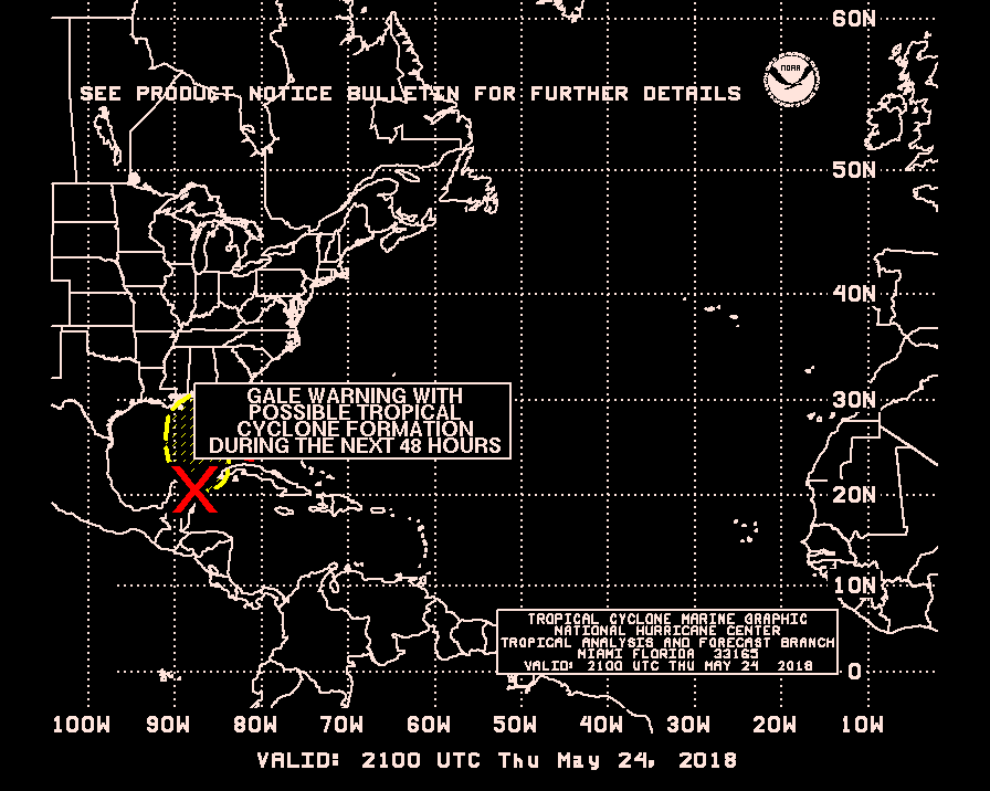
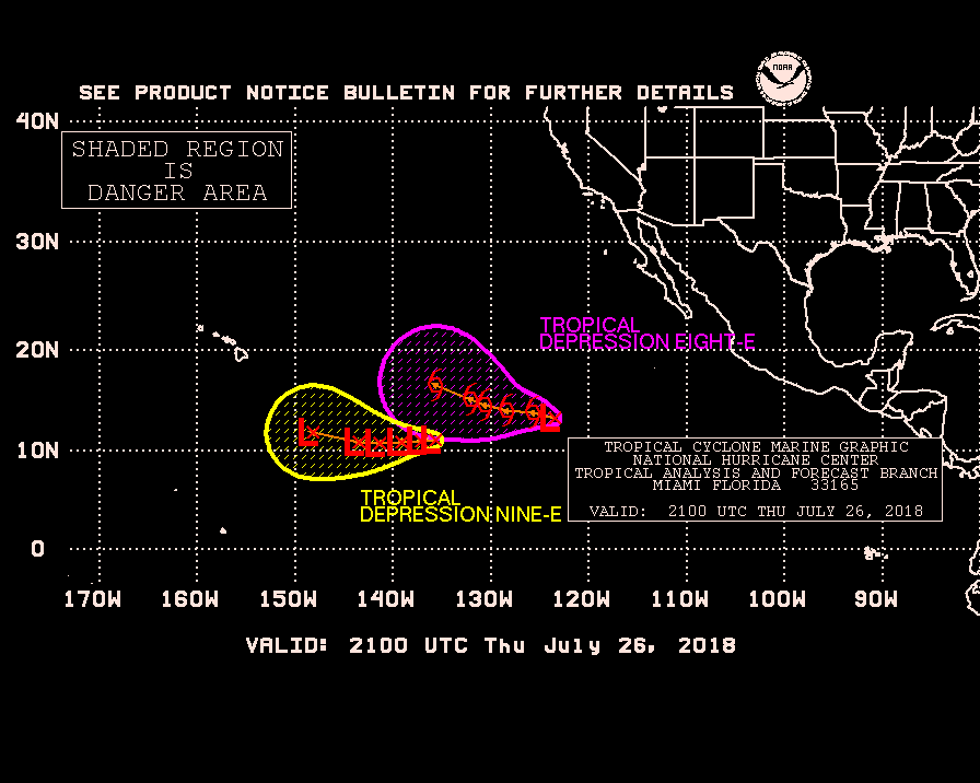
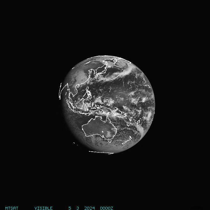
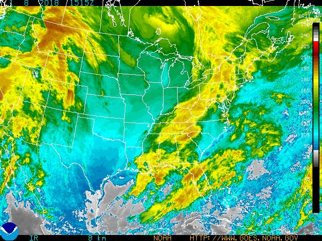
Satellite Image Links for Hurricanes Typhoons Tropical Storms

Select an earth area below - names are 'speed tabs'
IR means InfraRed - VIS means visible [daylight or moonlight]
Click NOAA below for greatest image array
Some GOES Satellite images below-listed may be adjusted for IR VIS WV & image loci & data color - see NASA GOES below
-color other than full RGB color=white-blue-violet-yellow-orange-red-
and is 'cloud temperature' rain & water condense in cooler clouds -
Select an earth area below - names are 'speed tabs' ...

NOAA NOAA FLOATER '20' NAVY GOES-NASA-MSFC
PR & WINDWARD CAROLINAS BERMUDA FLORIDA LOUISIANA BAHAMAS

CARIBBEAN ANTILLES HIS-CU-JA GULF MEXICO CENTRAL AMERICA S AMERICA
ATLANTIC NA-EASTÂ NA-WEST CANADA PACIFIC ASIA JAPAN SE Asia INDIA PAKISTAN HAWAII -Guam- Samoa

MONSOON India Pakistan TYPHOON
FOREIGN XO METEO HEMISPHERES (East & West & Indian Ocean) PRIVATE YAHOO-TWC

AFRICA Â


NASA SAT . NOAA SATS WV=2 color IR

white-cyan--bluevioletyellow-greenorange--red-

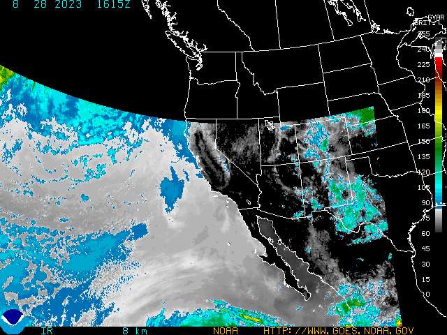
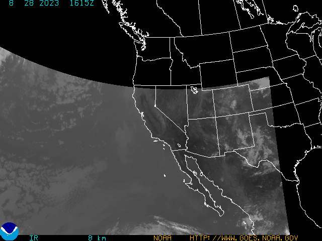
GOES Interactive Viewer - to Customize Images by matter or location-
NASA GOES Interactive Satellite Image Viewer
[zoom & data features to customize images]
[GOES -NASA-MSFC images & some NOAA otherwise ref color bar scale for interpretation]
Color gradients: cold >> hot - indicate cloud temperature - blues in some water vapor 2 color charts & lite bue to violet/magenta for water vapor or rain in 4 color enhanced B&W satellite images. Yellow >> reds = hot temperature with humid tropicality but less condensation due to heat.
GOES-NASA images showing water vapor with 4 colors show cooler wet rain clouds in bluer spectrum. Hurricanes show heat energy in red & the white center is the eye with clouds
GOES Satellite Images -'builder/user' instructions

Images are Real-Time when noted -use INFO key or Image Properties function for date/hour
NOAA-NHC Satellite Imagery Site
Latest NOAA Hurricane Floater Satellite Imagery ...storm close-up Atlantic-Carribean-Gulf of Mexico -some also listed below
 -floaters re-orient objective with event monitored-
-20 or 20's or 'Venteniales' refernces the Latitudes of the Tropics -the 20's-
NOAA GOES SATELLITE IMAGES
(still & loop ... loop links will set up a viewer for webtv - allow loop images to load)

State & Federal Emergency Links EMA FEMA

State EMA's Emergency Management Agencies also at this NHC link -use center page 'drop down' menu NHC -click


FLORIDA
Florida Disaster Agency
Florida Power & Light
Florida NWS Weather Radio
[Florida Satellite Images Above]

ALABAMA
MCEMA - Mobile Alabama Emergency Management Agency Alabama EMA
US Corps of Engineers -Hurricane Surge Readiness Report Alabama
Southern Co. lead electricity supplier Al-Ga-Ms -Click Power Company Heading

Georgia
Georgia EMA
Southern Co. - lead electricity supplier Al-Ga-MS -Click Power Company Heading

Mississippi
Mississippi EMA
MSU Cares -Disaster Planning
US Corps of Engineers -Hurricane Surge Readiness Report Mississippi
Southern Co. lead electricity supplier Al-Ga-Ms -Click Power Company Heading

Louisiana
Louisiana State Police Hurricane Emergency SIte
New Orleans Hurricane Surge - preparedness scenario NOAA
LSP New Orleans Contra-Flow Traffic Evacuation Plans
New Orleans Hurricane Preparedness & Emergency Office
City of New Orleans Official Site
Louisiana HLS-Emergency Preparedness
Louisiana State Police Emergency Information-Hurricane
Louisiana Power & Light ..'ENTERGY'

TEXAS
Texas Emergency Management - Disaster Response & Planning
Texas State Emergency Management Links -
(may require PDF for some files)
Hurricane Evacuations - Plans Routes
Hurricane Status Noticess
City of Brownsville TX Emergency Mgmt
NWS Brownsville Tx Radar Page

NORTH CAROLINA
NCEM - North Carolina Emergency Management

SOUTH CAROLINA
SCEMD - SOUTH CAROLINA EMERGENCY MANAGEMENT DEPARTMENT


US Federal Government
FEMA
NOAA Storm Tracker


RED CROSS
Hurricane Emergency preparations ..FAQ's Warnings Watches expalinedetc.
Red Cross Hurricane Emergency

International Weather Agencies World WXOther International & Regional Offices

Speed Tabs --


CDERA Mexico Venezuela Haiti Bermuda Netherlands Antilles
Bangladesh Vietnam WWO [UN]
Jamaica India Pakistan Australia Philippines
Colombia Cuba France Meteo Indonesia Japan
Thailand Taiwan Singapore CHINA KOREA
Canada Hong Kong Other Carib UN-Relief Web
Central Pacific: Hawaii-Guam-Samoa
South-West Pacific & Indian Ocean
India
French Polynesia - Tahiti WWO [World WX-UN]

WWO [UN]
WWO [UN] Participating Members

CDERA
Caribbean Disaster Emergency Relief Agency

UN relief Web UN list of distress affected regions & countries

The Weather Channel -Espanol
(arribe mucho mas rapidimente en espanol)


MEXICO
SMN CNA -Gobiernmento de Mexico

Avisos -indice defechas de boletines
Boletin Atlantico

Servicio Meteorologico - CNA
Cliqua 'Boletines' al barro alto; cliqua boton 'Alertas' al menu al margina izquerdial y selecta 'Temprana' por el mas recenté Boletin de Vigilanca o Alerta

- YAHOO-Mx Clima Mexico
Campeche
Nuevo Leon
Guerrero [Acapulco]
Gobierno Federal de Mexico
Gob de Mexico Huracan (temprana)
TABASCO [Tampico]
Matamoros -Cidudad Municipalidad
Tamaulipas [Matamoros]
- Yucatan
- Quintana Roo

Venezuela

Ministerio Ambiente y Naturales Recursos
Boletin Especial de Temporada de Huricanes y Tormentas Tropicales -MARNR-Venezuela

Pronostico de Tiempo Venezuela con Alerta por Huricanes

MARNR-Venezuela Servico Meterological

Imagenes de satellite a estas paginas
NB - in English -the URL for Venezuela's Natural Resources Ministry may fault unless 'gob' is substituted.

COLOMBIA
Huracanes Noticias
Huracanes
Map del Sitio IDEAM
(For some computer browsers the site's java tables which overlay [div] in tables the site index may be preferable.)

'Meteo-France' French Weather Service for Caribbean & West Atlantic France OutreMer-Antilles
METEO - from France meteorological Agency for Caribbean/Atlantique
Image de Satellite -Meteo France Hurricane Cyclone 'Courant'/ 'Tagant' Afrique Sd.Atlantique å Caribbeån
Métó RF Antilles
Météo RF [domtom]
Bulletins d'Alert - Cyclone de Meteo France -Antilles-Guyane
Bulletins specieux de vigilance
Bulletinsspecieux - marine
Météo France Guyane Antilles

Weather Dutch Antilles
Pages-Oranges Satelltes
Radar Martinique
Carte de Vigilance
Meteo.fr demarrage des cyclones
Meteo.fr OMAR Meteo.fr OMAR Trajectoire
Meteo GP

demarrage carte cyclone path Hurricane tracker
Hurricane Path from French Caribbean weather service 'Meteo France -Antilles'
(scroll down at page - use menu to see a chart like this Ourican OMAR)

Météo France -Antilles

ESSI.fr - RFI Meteo France Bulletins Ouest Atlantique

Météo-Tropicale
images de satellite météo

French Polynesia
French Polynesia Weather Satellite Metéo France en Polynesie
Polynesie francais Météo images satellites Météo Polynesie francais

Netherlands Antilles
Weather NL Antilles
Weather NL Antilles Cyclones Page

Martinique Radar


'Meteo France'= French Weather Service

BERMUDA
Bermuda Weather Agency
"Shark-Oil" ---Bermuda Weather
Shark Oil HOME

CANADA
CANADA Weather Agency Météo

Canada GOES Satellite North America

Satellite Image Canada Hurricane Tracking

Caribbean & Western Atlantic Hurricane Links
NOAA-Caribbean Satellite::HIS-CU-JA
Other Caribbean & near Atlantic

HAITI ... AYITI
le météo .. via Metropole-Haiti et TWC

JAMAICA

Government - Jamaica Information Service
Jamaica Gleaner
(Gleaner site opens to current front day page -URL will change)

CUBA

Cuban Meteoroligical Agency -Institute of Meteorology INSMET

INSMET-Cuba Satellite Images Page - 'genesis'
Cuba & Surrounding area .. expanse to Gulf and local waters .. Water vapor-Infra-red & realTime Visible + Radar page -- NB - some ISP's (servers) will not serve -Cuba site is 'Govt' of Cuba ... but because Cuban Phone Company may affix surcharges on the ISP phone call . (Info-news exchanges permitted under rules of US EMBARGO for US ISP's but surcharge is problem)

Caribbean Weather Net Martinique Radar
Turks & Caicos WX
Bahamas Storm-Fax
CaribWX Satellite
CaribWX
Abaco Today Weather
CNN Florida Weather Radar


Japan
JMA Typhoon
JMA Typhoon Forecast
JMA -main site

KOREA
Korea-ROK KMA

TAIWAN
CWB
Central Weather Bureau [english] [click TYPH in left menu on site]
TAIWAN TYPHOON WARNING

CHINA
China - Peoples Republic

National Meteorological Center
CHINA-NMC Typhoon Forecasts Info

Hong Kong
Hong Kong Observatory
HKO Typhoon Warnings Will be in -Local Weather Forecast Hong Kong -text Bulletin here --also available Real Player Audio file
HKO WAP

SINGAPORE
Singapore National Environment Agency
-typhoon warnings link - satellite WX image SE Asia MTSAT-

VIETNAM
Vietnam National Hydro-Meteorolgical Center

INDONESIA
Indonesia Weather Bureau Bandan Meteorologican Bandan Meteorologican Indonesia
Indonesia - via MyForecast.com


PHILLIPPINES
PAGASA -Philippines Weather Agency
[NB Philippine Gov't does not use Int'l Typhoon Naming Roster -has its own list of names]

AUSTRALIA
Tropical Cyclones -WMO-Australia -Severe Global Weather
Gov't Australia Bureau of Meteorology
Australia Weather Warnings Summary

Australia WX Sat -MyForecast.com
YAHOO-TWC Australia/ NZ WxSat
Aussie WX SAT

PAKISTAN
PAK-MET
Weather Update -Earthquake Affected Areas

INDIA
*
MONSOON
India Meteorology Dep't -Monsoon/Tropical Cyclones/Severe Weather
-see also Australia BOM above for WMO links

BANGLADESH
Bangladesh Meteorological Department

Thailand
Thaland Gov't Weather -Tropical +
Thailand site in Thai language/font
Thai-Met Weather
Thai-Met - Thailand Meteorological Agency


WORLD -Other
World Weather Agencies WX -Tropical Cyclone Affected

WWO [UN]
WWO [UN] Participating Members

Central Pacific: Hawaii Guam Samoa .. South Pacific - Tahiti & Australia Vanuatu Solomons NZ Far East - Japan Asian Mainland

NOAA-NWS Central Pacific Hurricane Center
NOAA-NWS CPHC
NOAA Wind-Wave Danger East Pacific
NOAA Satellite Series Central & East Pacific
TWC Hawaii Sat
NWS Radar Mosaic Hawaii
Hawaii Sat Image -"MyForecast"
NOAA-NNLV Images (static -- not always current time)
Joint Typhoon Warning Center - Japn & Western Pacific Interests
Hawaii NOAA-NWS Radar mage Map

NOAA-NWS Central Pacific Tropical Storm Warning Center [Guam .. West of Hwaii etc - see JTWC also]

NOAA-NWS American Samoa Current Weather
NWS American Samoa Radar-Satellite Imagery
NOAA Home Pago Pago American Samoa

YAHOO-TWC Oceania Weather by Country Island City

YAHOO-TWC Australia Satellite Australian Government Weather Satellite
Satellite Image & Weather French Polynesia

Japan Meteorological Agency

Other Caribbean Links + BBC


BBC Caribbean Links
BBC Caribbean News site
BBC-Share Tropical Storm Experiences Internet Radio -BBC 2 separate audio programs:
BBC Caribbean Morning Report Real Audio G2 ram
BBC 'Caribbean Report' Internet 'shortwave' broadcast BBC Radio -RealAudi0 G2 RAM

Lenny's Jamaican Hurricane Links
Storm Carib

E-Mail & Mobile Phone or Pager Alerts

IBSYS E-Mail & Mobile Alert
Select your TV Market link from the list & subscrbe -free- to their e-mail alert sign-up - select weather (this may require a PC for sign-up -reference their 'SITES' link on the left margin)
Emergency E-Mail
NHC-NOAA E-Mail & Mobile Advisories
Subscription -free- form at bottom of linked page

Emergency Equipment
Equipped.com PLB's & Kits

TV & Radio Links

Click for WWW Site or (WebTV Click Network Acronym to tune channel)
MSNBC Weather .. NBC TV ... MSNBC TV
CBS News Severe Storm Information ... CBS TV
weather.com ...TWC The Weather Channel
CNN Weather ... CNN TV
ABC News/Wealther-Local ... ABC TV
Fox-TV News Weather ... FOX TV
Clima Tempos Univision TV ...UNIVISION TV
Telemundo ... TELEMUNDO TV
NECN.com ... NECN-TV
NWCN.com ... NWCN TV
BBC Weather ... BBC TV

NOAA NWS NWR National Weather Radio
NOAA/NWS Weather Radio
NOAA National Weather Radio NWR frequencies
SAME Codes - specific county messages where available

National Weather Service NWS-NOAA list of NWS weather radio stations -those with 'audio' have on-line -internet availablity
MARINE Radio NWS with SAME code
NWS Marine SAME Codes

BBC Caribbean
Internet Radio -BBC 2 separate audio programs:
BBC Caribbean Morning Report Real Audio G2 ram
BBC 'Caribbean Report' Internet 'shortwave' broadcast BBC Radio -RealAudi0 G2 RAM
Share Hurricane Experiences with BBC World Service - Americas -E-Mail Form on Page
BBC Caribbean.com
BBC Radio Frequencs & Schedules -Caribbean
BBC Caribbean News - source of audio files & more regional news

Voice of America -Hurricane Ivan
Voice of America - News Now RealAudio ram

U Fla Amateur Radio Weather Emergencies - HAM

WeatherAudio.net

Midland Radio
sells weather band radios - Radio Shack sells the Midland WR-100 for $39.95 (price may vary elsewhere to $59)

RED CROSS
Hurricane Emergency preparations ..FAQ's Warnings Watches expalinedetc.
Red Cross Hurricane Emergency

Internet Radio
NOAA WX RADIO Miami area NOAA Weather Radio


MIAMI NOAA Radio Tropics Forecast -Click here http://www.srh.noaa.gov/images/rtimages/mfl/nwr/audio/MIATWOMIA.mp3
http://www.srh.noaa.gov/images/rtimages/mfl/nwr/audio/MIATWOMIA.mp3
BBC Caribbean News site
BBC-Share Tropical Storm Experiences Internet Radio -BBC 2 separate audio programs:
BBC Caribbean Morning Report Real Audio G2 ram
BBC 'Caribbean Report' Internet 'shortwave' broadcast BBC Radio -RealAudi0 G2 RAM


Current Storm -WX links - more for non-tropical season -some duplicate
Hurricane Typhoon Watch Blog

Hurricane Watch Net -additional e-mail relay of NHC-NOAA bulletins in season

Hurricane-Typhoon-Monsoon Watch Group 'ourican' at YAHOO
-free to join -

RSS for Hurricane-Typhoon-Monsoon Group 'ourican'

Tropical Storm Reconnaissance - US NOAA & USAF
-- US aircraft collect barometric pressure; drop tracking devices; make measurments etc. - overflying storms etc - 'Hurricane Hunters'

WEBMASTER
Additional disclaimers -- no attempt is made by the webmaster or this page to substitute for official or professional private weather forecasting. Pages consist of links to satellite imagery & other weather forecast centers with occasional sumamryies of official bulletins with source attributions.

TOP

TOP

Tropical Storm 'gif' symbol from JTWC - otherwise use dollar sign - $ $-


Powered by MSN TV
next page