&quality Current Storm Info -- scroll down for links


MOBILE >>> HERE
and mobile here
Current Storm Info -- scroll down for links

click for tropical storms $$-Tropical WWO-Météo-Mondial (UN) WX-SAT Images [ok for mobile]


Warnings Map Alone - click here

warnings map white bg

click for tropical storms $$-Tropical

HPC - NOAA-NWS Tropical Storm Wind-down WX Advisories
NOAA-HPC
NOAA CONUS/NA WX Chart
NOAA CONUS/NA WX Carta [esp]
Latest MSFC GOES Image
Mexico SMN Avisos Tormentas Intensas & Granicos
Wunderground Lite
IWUND Wunderground Touch
TWC -Mobile-Lite Weather WX
TWC Hurricane Central
NWS Lite & Mobile Weather Info [radars satelites forecasts warnings]
PDA -- http://www.nhc.noaa.gov/mobile/index.html
CELL-- http://www.nhc.noaa.gov/index.wml
AccuWeather Lite [wap]
Accuweather Mobile
GOES NHE Sat Image IR-4 USA East
GOES NHE Sat Image Water VaporUSA East
GOES NHE Sat Image IR-4 USA West
GOES NHE Sat Image Water Vapor USA West
IR 4

GOES NHE Extended -zoom 1 over NE North America Infra-Red & B&W

GOES EAST FULL zoom 2 B&W IR-4

GOES EAST FULL zoom 2 B&W IR

GOES NHE SAT - MSFC-NASA -zoom=2 - Caribbean >> SE N America
'My Forecast.com" NorthEast USA Sat Image


Forward Weather [01089]

WX for wireless wap pda mobile

http://scottmcon.fortunecity.com/tropwx.html

PDA -- http://www.nhc.noaa.gov/mobile/index.html
CELL-- http://www.nhc.noaa.gov/index.wml

GOES NHE Sat Image IR-4 USA West
GOES NHE Sat Image Water Vapor USA West

CONUS-West
IR B & W
IR 4

GOES NHE Extended -zoom 1 over PACNW Infra-Red & B&W

GOES PACUS & ALASKA
GOES-PACUS IR B & W -USA PAC-ALASKA
GOES-PACUS IR-4 B & W -USA PAC-ALASKA

GOES-PACUS IR B & W -USA PAC-NW
GOES-PACUS IR-4 B & W -USA PAC-NW

NWS ALASKA


CONUS-East
IR B & W
IR 4

GOES NHE Extended -zoom 1 over NE North America Infra-Red & B&W

GOES EAST FULL zoom 2 B&W IR-4

GOES EAST FULL zoom 2 B&W IR

GOES NHE SAT - MSFC-NASA -zoom=2 - Caribbean >> SE N America
'My Forecast.com" NorthEast USA Sat Image

GOES EAST Great Plains & Mountain States
GOES EAST B&W IR-4 zoom 4 via NASA

NOAA GOES SATELLITE IMAGES
(still & loop ... loop links will set up a viewer for webtv - allow loop images to load)

HAWAII & E PACIFIC
NOAA-NWS Honolulu HQ
NOAA-NWS CPHC
GOES Global Composite via NASA MSFC IR-4 NA-West to Hawaii
GOES E FULL 18.0N 141.0 W E Pacific Mexico >> Hawaii IR-4
GOES E FULL 18.0N 141.0 W E Pacific Mexico >> Hawaii IR B&W
NOAA Pacific Hurricane Floater IR
GOES W-Pacific-US IR PACUS >Hawaii
Global Composite IR via NASA MSFC
TWC Hi-SAT
Tropical Storm Tracker U-Hawaii
Storm Track

Central Pacific Hurricane Center CPHC
NOAA Central-Pacific Satellite RGB [color] Image
CPHC -- Track -Images - Advisories - Forecasts -
NOAA-NWS CPHC
NOAA Wind-Wave Danger East Pacific
NOAA Satellite Series Central & East Pacific
NWS Radar Mosaic Hawaii
Hawaii Sat Image -"MyForecast"
NOAA-NNLV Images (static -- not always current time)


WX for Pakistan earthquake affected areas - from PakMET

oggi espatiale Meteo-Olympico WX Europa

[ see local weather bureaus for latest weather per local inte


NOAA OPC [ocean prediction center] Atlantic & Pacific [surface analysis weather maps & charts]
Atlantic Weather Map


NOAA Internet Weather Service -latest 24 Hour reports by major airport/city
NOAA-IWS USA
NOAA-IWS-International

Weather Maps Legend [symbols key]
Tropical Analysis Forecasting Branch [Tropical Weather Discussion]
Atlantic Tropical Weather Discussion

WILDFIRE WX & DANGER

NOAA Fire WX
NOAA Satellte Imagery
WildFire Assessment

East & West Coast North America Satellite & Graphic Views

Bottom of Page $$-Tropical
Scroll down for more links
NOAA Satellite Image Eastern North America
NOAA West Coast Satellite Image
IR CONUS-WEST COAST NOAA
IR CONUS-EAST COAST NOAA

GSFC-NASA GOES Images

NASA-GSFC-GOES CONUS-West Color Image - Pacific [left side of country]
NASA-GSFC-GOES CONUS-East Color Image - Atlantic [right side of country]

http://goes.gsfc.nasa.gov/goesproject_west.html
http://goes.gsfc.nasa.gov/goesproject_east.html

GSFC-NASA home if the images are down -use this for an index

NASA-GSFC GOES-12 IMAGE full color -latest USA-East
GOES 12 NASA-GSFC Color Image Latest USA-West
WIND WARNINGS ATLANTIC
Global Composite Sat Image Atlantic
NOAA-MSFC North Atlantic IR-4 to east of Newfoundland
NOAA-MSFC North Atlantic IR-2 to east of Newfoundland

NOAA East Conus Satellite
IR CONUS-EAST COAST NOAA

NOAA GOES-NHE satellite image IR-4 NASA MSFC
NASA-GSFC GOES-12 IMAGE full color -latest USA-East
GOES 12 NASA-GSFC Color Image Latest USA-West

NOAA National Doppler Radar Picture
http://www.weather.gov/
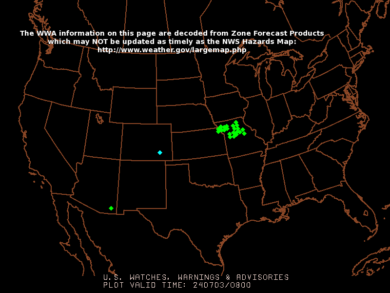
NOAA-NWS Weather Alert Map - CONUS

RADAR
NWS RADAR
NOAA-NWS RADAR - MOBILE Lite Site - select radar & forecast

Then select high resolution base image -- you'll see a result lke this for Miami - Florida

[If still able to reach the old NWS Radar page, then, use compass graphic in left page corner for further navigation on each NWS Radar page - Radar also available via YAHOO with TWC ]


NOAA Current US snow cover
Alaska Current Snow-cover
Asia-Erope Current Snow-cover
Afghanistan Current Snow-cover
US - USGS -Water Table Map Image [saturation & stream flow] - Legend-high - low: HIGHHIGHERNORMALVERY LOW

USGS Streamflow Data Site - Water Table & water flow
US EPA Watershed Locator
NOAA National Data Buoy Center
NOAA US Seasonal Drought Outlook
NOAA [CMI] Crop Moisture Index

Current Storm Info Links

IWIN NWS Warnings Table
NWS-NOAA Warnings Display Page
NWS-NOAA Warnings DIsplay Map
Hurricanes & Tropical StormsNWS Hurricane Warnings
Use 'Find' key & type storm name or your area
[ function under 'view' for windows toolbar ]
NWS All Warnings
Read Each Category -ie wind precipitation flood
Weatherbug Storm Central
Storm Display Warnings Map - US 'Weatherbug'

NWS Warnings & Big Picture

NOAA National Doppler Radar Picture [WEATHER MAP]
NOAA National Weather Radar Picture & Weather Links
NWS All Warnings
Read Each Category -ie wind precipitation flood
Winter Storm Warnings
Use your "FIND" key (under 'edit' for PC's) .. and look up your state.
NOAA Weather Watches-Warnings Map Graphic
List of warnings with national map graphic
NOAA OPC [ocean prediction center] Atlantic & Pacific [surface analysis weather maps & charts]
Atlantic Weather Map


NWS Eastern Region
NWS Western Regional Weather
NWS Southern regional Weather

YAHOO Weather / uses data/graphs of Weather.com (The Weather Channel )
YAHOO Weather NWS Storm Warnings
(displays your locality so bookmark or link yours ie:) US-Ma0469

The Weather Channel [TWC]
Links: slow for dial-up, faster with DSL-broadband & sunscription
Tropical Update - Images & Maps
Weather.com Maps


NOAA NHC Local Area Hurricane Warnings
NWS Local Forecast Office

NOAA Weather Radio -NWR- & SAME Codes
Specific County Messages where available
NOAA-CO-OPSTides et al
Tides On Line -NOAA

NOAA High Wave/Wind Danger Area
NOAA RadioFAX Info
Broadcast Bands & schedules for RadioFAX Info

NOAA NWS Hurricane Warnings
NOAA National Hurricane Center text-info site
National Hurricane Center-NOAA
NHC NOAA Tropical Prediction Center

NOAA GOES Satellte Array

USGS -Stream Flow & Water Table Saturation Flood Risk

USGS Streamflow & Water Saturation
USGS Stream Flow -National Look

Tide Tables for Storm Surge Tide
Anywhere Tide Tables FreeTides.com
NOAA-CO-OPSTides et al
Tides On Line -NOAA

Wave Danger
NOAA High Wave/Wind Danger Area

E-Mail Mobile Alerts & Advisories

IBSYS E-Mail & Mobile Alert
Select your TV Market link from the list & subscrbe -free- to their e-mail alert sign-up - select weather
Emergency E-Mail
NHC-NOAA E-Mail & Mobile Advisories
Subscription -free- form at bottom of linked page

Puerto Rico & VI Leeward Carribbean

NOAA-NWS Short Range Radar - Puerto Rico & VI Carribbean/Atlantic
Long Range Radar
Puerto Rico & Carribbean -Visible Satellite Image
Puerto Rico & Leeward/Windward Visible Satellite Image
Puerto Rico & Leeward/Windward Infra Red Satellite Image
GOES Satellite Image Puerto Rico & Leeward/Windward
NWS-NOAA IWIN Puerto Rico Infra Red Image Leeward/Windward

Florida

Florida NWS Weather Radio
Wunderground GOES-8 IR Florida & Bahamas
Florida NOAA Satellite Image IR2
Florida NOAA Satellite Image -Visible
Florida NOAA Satellite Image IR4
NWS-NOAA Melbourne Fl Radar Image -Long Range
NWS Melbourne Fl Weather & Radar Page

Alaska

GOES Alaska Infra Red
NWS Alaska WxRadio
Alaska Thermal Image -nfra Red

Far East Pacific & Indian Ocean Satellite Images

NOAA GOES Indian Ocean -Infra-Red
Far East-Paciifc Visible Image Satellite
Far East-Paciifc Infra-Red
Yahoo Weather -The Weather Channel-Asian Satellite Image
Select any ocean or continent
Also clcik on Hurricane-Typhoon Site
Weather Underground - Tropical Weather Site

EUROPE

METEO-Live Italy

TV Links

Click for WWW Site or (WebTV Click Network Acronym to tune channel)
MSNBC Weather .. NBC TV ... MSNBC TV
CBS News Severe Storm Information ... CBS TV
weather.com ...TWC The Weather Channel
CNN Weather ... CNN TV
ABC News/Wealther-Local ... ABC TV
Fox-TV News Weather ... FOX TV
Clima Tempos Univision TV ...UNIVISION TV
Telemundo ... TELEMUNDO TV
NECN.com ... NECN-TV
NWCN.com ... NWCN TV
BBC Weather ... BBC TV

Radio Links

NOAA NWS NWR National Weather Radio
NOAA/NWS Weather Radio
NOAA National Weather Radio NWR frequencies
SAME Codes - specific county messages where available

National Weather Service NWS-NOAA list of NWS weather radio stations -those with 'audio' have on-line -internet availablity
MARINE Radio NWS with SAME code
NWS Marine SAME Codes

BBC Caribbean
Internet Radio -BBC 2 separate audio programs:
BBC Caribbean Morning Report Real Audio G2 ram
BBC 'Caribbean Report' Internet 'shortwave' broadcast BBC Radio -RealAudi0 G2 RAM
Share Hurricane Experiences with BBC World Service - Americas -E-Mail Form on Page
BBC Caribbean.com
BBC Radio Frequencs & Schedules -Caribbean
BBC Caribbean News - source of audio files & more regional news

Voice of America -Hurricane Ivan
Voice of America - News Now RealAudio ram

U Fla Amateur Radio Weather Emergencies - HAM

WeatherAudio.net

Midland Radio
sells weather band radios - Radio Shack sells the Midland WR-100 for $39.95 (price may vary elsewhere to $59

Other Links

USA Today Weather

Hurricane -Typhoon Strength Scale -Island-Net
Super Typhoon.com

Severe Weather Map-USA
from EmergencyEmail.org -also Emergency E-Mail Warnings
FEMA Storm Emergency Site


Red Cross

Equipped.com

HAM Weather.net
The WEATHER Channel
Wunderground
Weather Underground - Tropical Weather Site

StormDisplay WeatherBug
US Coast Guard
FEMA State Emergency Offices List

Relief Web

Caribbean Disaster & Emergency Relief Agency
Hurricane IVAN report this link


Red Cross
Disaster Relief

NOAA Gulf Coast Hurricane Histories
HurricaneCity.com City Hurricane History Odds & Impacts

M鴩o France Antilles-Guyane
M鴩o France outre-mer
M鴩o Frances -acceuil
M鴩o-Tropicale
Sirocco Accuweather
images de satellite m鴩o
BBC-Share Your Tropical Storm Experiences -E-Mail Report Form on Line
BBC Caribbean.com
BBC Radio Frequencs & Schedules -Caribbean
BBC Caribbean News
BBC Caribbean Weather
BBC Portada del Mundo
BBC Noticias en espa񯬠RealAudio ram G2

Links are for current -real time - images & info ..last update of this page is obtained by clicking "Info" [check under View or Edit for 'properties' - for MSNTV/webtv click info key"

Weather maps Jamaica Gleaner
Jamaica Gleaner

Hurricanes-Cyclones-Typhoons-Monsoon - more

Hurricanes & Tropical Storms - Info Forecast Images & Links - click here
Satellite IR Image East Coast
NOAA-NWS Satellite Image Infa-Red East Coast
NOAA-NWS Satellite Image Northwest Atlantic US East Coast to Tropics Latitude 20?

YAHOO NWS Weather Warnings
GOES East Fltr Satellite Image Atlantic Caribbean Lat 20?


Site Index

Webmaster
TOP


TIDAL WAVE TSUNAMI WARNINGS TIDAL WAVE TSUNAMI WARNINGS (2) >>>> NEXT PAGE


Powered by MSN TV
next page